Boating
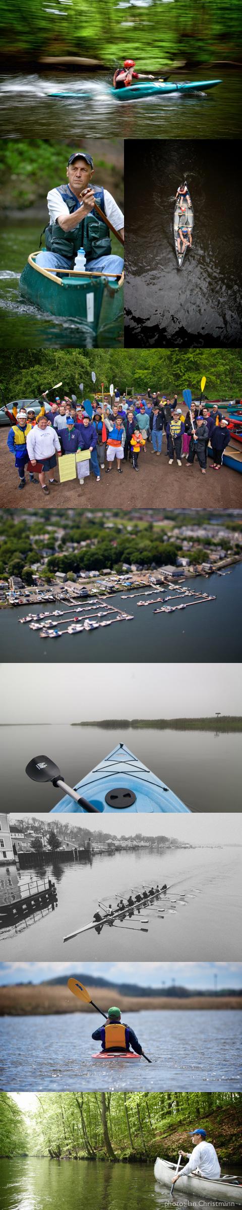
The Quinnipiac is a winding and slow-moving river that is ideal for peaceful canoe or kayak rides. One of the longest greenways in the state, the river offers many opportunities for spotting wildlife and rare bird species. It also opens a window to the past as it flows by the remains of old factories and settlements. Boat launches for small crafts can be found at multiple points along the river and are described below and on the map. Motorized boats are limited to the river’s mouth south of I-91, and have access to Long Island Sound.
Upper Quinnipiac
Plainville
Route: Dead Wood Swamp (headwaters) to Plainville-Southington Line Length: Approximately 2.4 miles
AccessPoints:
• Hamlin Pond, Dewey Place
• Tomlinson Avenue
• Shuttlemeadow Road
Canoeing Tips:
• From Shuttle Meadow Road Access,take short trips to the north and south
Notes of Interest:
The Farmington Land Trust has information about the history of the Dead Wood Swamp area. A trail exists in that area that parishioners from New Britain would travel in the 1700s to reach the Farmington Congregational Church.
Plainville Historic Center, 29 Pierce St. has an extensive permanent display of the Farmington Canal, which passed through Plainville.
Southington
Route: Mill Street, Southington to Route322; Southington
Length: Approximately 6 miles
Time: 2 - 3 hours
Access Points:
• Queen St. Pump Station,north of RiverSt.
• Mill Street bridge at Town Park
• Canoe ramp I00ft. east of Rt. I0 across from Apple Valley Bowl
• Route 322 Bridge
Canoeing Tips:
Generally passable only during spring and higher water conditions.
Generally easy paddling from Mill St.
USE CAUTION when approaching portage at 4-foot Plants Dam near Bowling Lanes, just north-west of Route 10. Portage on left bank is recommended.
There may be occasional blockages.
The stretch from Mill Street to West Main Street is a narrow, shallow channel.
Below West Main Street, the Eight Mile River joins the Quinnipiac, effectively doubling the volume of water in the river.
Notes of Interest:
The Quinnipiac, Eight Mile River, and Ten Mile River all support native trout.
The Ten Mile River is stocked with trout by the Connecticut Department of Environmental Protection.
Cheshire - Meriden
Route: Route 322, Cheshire to Hanover Pond,Meriden
Length: Approximately 5 miles
Time: 2 - 3 hours
Access Points:
Route 322 bridge at Southington/Cheshire line
Cheshire Water Pollution Control Facility
Sindall Rd., Cheshire at Carpenter's dam by old Meriden pump house
Red Bridge (intersection of Oregon Road and River Road), South Meriden
Dossin Beach at Hanover Pond, Oregon Road, Meriden
Habershon Field at Hanover Pond, Camp Street off Main Street (Rt. 70), Meriden. There also is a public boat launch here for trailered and motorized boats.
CanoeingTips:
Portage at Carpenter's Dam (3.5 miles from access point at Route 322) on the left bank
Watch out for submerged pipe 150 feet upstream of dam.
Generally easy paddling to Carpenter's dam, though some experience recommended to maneuver around tree falls and sharp turns, especially during extreme high and low water levels.
During summer, the water can be low so be prepared to drag your boat over shallow stretches.
Some experience in whitewater recommended from Carpenter’s Dam to Red Bridge during high water periods. During lower water periods, this is a good whitewater learning area.
•Hanover Pond is shallow and an excellent learning area for general canoeing skills.
Other Activities
At Riverbound Farm on the left river bank, just south of the 1-691 bridge, a loop hiking trail is maintained by the Quinnipiac Valley Audubon Society.
Birding is good along the riverside hiking trail at the Water Pollution Control Facility
Hiking is available on a 1 ½ mile trail along the left bank from Oregon Road to Carpenter’s Dam. The trail follows the old Meriden-Waterbury Railroad right-of-way but is not marked. The path is well-worn, however. The trail is also a good cross-country skiing path in the winter.
Fishing is recommended along this entire stretch. The bridges at East Johnson Avenue and Blacks Road are good access points. The stretch from Carpenter’s Dam to Oregon Road is stocked, and is accessible from Carpenter's Dam down to Oregon Road along Route 70 on the right bank (please respect private property!), or along the hiking trail on the left bank.
Notes of Interest:
This stretch is the course for the Quinnipiac River Watershed Association’s annual Downriver Classic Canoe Race.
In the 1800s, at least two mills, an ice house, four iron bridges and a railroad existed along the river from Cheshire Street to Red Bridge.
Red Bridge is the oldest bridge spanning the Quinnipiac. It was built in 1891 by Berlin Iron Bridge Company, in Berlin, Connecticut, which was then New England's largest structural fabricator. This wrought iron lenticular truss is among the 600 surviving lenticular trusses out of over 2,000 erected in the United States and is one of only twenty five remaining in Connecticut.
MIDDLE RIVER
Meriden - Wallingford
Route: Hanover Pond, Meriden to Route 68, Wallingford
Length: Approximately 5 miles
Time: 2 ½ - 3 hours
Canoe Access Points:
• Dossin Beach at Hanover Pond, Oregon Rd., Meriden
• Prageman Park, Oak St., Wallingford
• Britannia Spoon building, 300 Church St., Wallingford
CanoeingTips:
• Easy paddling throughout.
• Portage at dam on Hanover Pond; follow the marked path to the right of dam.
• From Prageman Park one can attempt to paddle upstream to just below Hanover Dam, thus avoiding the portage, or cruise downstream to Brittania Spoon Company.
• Sand bars and fast currents present challenges between Hanover Dam and Oak Street.
• Portage is necessary at the Brittania Spoon building; the dam has been breached and the bipass channel to the left of the dam is not passable. Portage to the right of the dam. The Brittania Spoon building is now home to Westbrook Lobster.
Notes of Interest:
During the 1800s, the cutlery industryt hrived along this section of the Quinnipiac. Hanover Pond was dammed for power by the Meriden Cutlery Company and five miles downstream another dam was erected to power the Brittania Spoon Company.
Habershon Field was the site of an amusement park, a roller skating rink, and by some accounts a horse track.
Across the pond in the late 1920s, Dossin Beach was built with itsV ictorian bath house and fine sandy beach.
In the 1920s and1930s, the Meriden Polar Bear Club made Red Bridge the platform for their shivery wintertime plunges into the icy riverbelow.
Walingford - North Haven Warning: Downed trees require multiple portages along this stretch.
Route: Rte 150 YalesvilletoToellesRoad, Wallingford/North Haven ;
Length: Approximately 5.2 miles
Time: 2 hours
Access Points:
• Route 150 bridge, Yalesville, southwest corner of bridge
• Quinnipiac Street, Wallingford access point is on the left bank near the spillway.
• Toelles Road, Wallingford/North Haven. Access is best on left downstream side of bridge. Lack of parking is a problem.
Canoeing Tips:
•The river in this stretch is generally slow-moving in a meandering and relatively flat channel. Depths are generally a few feet or less with numerous sandbars and occasional deeper channels and pools.
• Portage around spillway at Quinnipiac Avenue on right bank.
• Shortly downstream of Route 68, the channel splits around a large island. The left channel is the more passable of the two, but it is generally shallow and may require dragging canoes over sand bars at various locations, especially during low water.
• There is a scenic stretch from Route 15 to Hall Avenue, a former lakebed, which is wide and relatively deep in most spots.
• The segment from the Quinnipiac Avenue crossing to Toelles Road may be difficult to negotiate due to blockages, mostly occurring downstream of the Wallingford sewage treatment plant. The channel splits into two substantially smaller channels a short distance downstream of the Wallingford sewage treatment plant discharge with the more passable of the two being to the left.
Other Activities:
Various wildflowers, wetland vegetation and wildlife can be viewed in the marshes around Community Lake Park. Many turtles lay their eggs in the sandy lakebed soil.
The Quinnipiac River Linear Trail is accessible for hiking.
Notes of Interest:
For more than a century, a dam at Hall Avenue created what was known as Community Lake, once a popular public park. The dam was breached during a storm in the late 1970s, causing the lake to drain. The current river channel cuts through the former lakebed sediments, resulting in steep channel banks several feet high and composed of fine sand and silt. The broad floodplain which formed the former lake bottom contains a variety of marsh vegetation and wildlife. The lakebed also contains three excavated ponds, dug to provide sand for the Wallingford Public Works department.
Lower Quinnipiac
North Haven - Warning: Downed trees
Route: Toelles Road, Wallingford/North Haven to Sackett Point Road, North Haven
Length: Approximately 5 ½ miles
Time: 3-4 hours
Access Points
Toelles Road Bridge: The best access is on the left, downstream side of the bridge. Note: no parking is available.
Banton Road Canoe Launch: Parking is at the lot for Quinnipiac River State Park and the canoe launch is behind the Mobil station.
Broadway Bridge (downstream of Route 22) on the left bank upstream of the bridge.
Sacket Point Road: Take the road between Tilcon and Frankson Fence down to the river to the boat launch.
Canoeing Tips:
Below Broadway is the Red Sandstone Railway Bridge. CAUTION: The bridge is passable at high tide through the right side openings, but proceed with caution during low tide; the bottom here is lined with brick and can damage canoes.
Notes of Interest:
Toelles Road to Banton Street is a gently winding stretch of river. On the left side is a unique terrain known as the North Haven sand plains. The right bank of the river is bounded by Quinnipiac River State Park. This undeveloped park was formed in the 1940s, when the construction of the Wilbur Cross Parkway (Route 15) cut off these farmlands from the homesteads on upper State Street and Hartford Turnpike.
Banton Street to Sackett Point Road is about 2.5 miles and takes about 1.5 hours. The Banton Street area was once an active summer community which acquired the nickname "Little Savin Rock". Seawalls and docks are still visible along the banks.
At high tide, the Muddy River, which enters the main channel just south of Sackett Point Road, can be paddled a significant distance.
Immediately below the Red Sandstone Railway Bridge is the former site of the Stiles Brick Company, where many old bricks still can be found in the area downstream.
The river changes its character as upland woodlands give way to cattail marsh and sycamores give way to large willow trees. Wood duck nesting boxes dot the riverbanks and canals cut through the marsh. The canals were dug in the 1930s as a WPA project for mosquito control.
North Haven - New Haven
Route: Sackett Point Road to Grand Avenue Bridge
Length: About 6 miles
Time: 2- 3 Hours
Access Point:
Sackett Point Road Bridge
Canoeing Tips:
This section is a wide, deep channel with slow-moving water which is affected by tides. High tide at Sackett Point follows New Haven harbor by two hours. Plan to put in an hour before high tide at to ensure adequate water depth for side trips.
CAUTION: Underneath the Middletown Avenue Bridge in New Haven the current is fast and treacherous with turbulence by the pilings. Conditions are safest at slack tide.
Notes of Interest:
Pemican Island, about one mile downstream of Sackett Point Road is bald eagle nesting area in winter in this area.
Nesting ospreys may be observed on the left bank in an old light tower downstream of the abandoned Cedar Hill railroad yards, and on osprey platforms in the salt marshes. Bird surveys have documented many clapper and Virginia rails, and even several rare,state-listed species:
least bittern, moor hen, and king rail.
New Haven
Access Points:
Dover Beach Park on Front Street and Clifton Street, across the river, also have boat launches for small crafts.
The Quinnipiac River Marina & Boathouse Café, 309 Front Street in Fair Haven, is a full-service marina located at the mouth of the river. In addition to renting slips and dock space to motor boats, the marina rents kayaks and canoes.
Canoeing Tips:
The easiest paddling is on the east side of the river.
CAUTION: The railroad bridges next to 1-91 have narrow channels with swift moving currents and should be avoided.
Notes of Interest:
South of I-91 on the east side, the Quinnipiac Meadows/Eugene B. Fargeorge Preserve http://www.newhavenlandtrust.org/preserves/quinnipiac-meadows is a habitat for multiple bird species including Ospreys, Bald Eagles, ducks, geese, and sandpipers. The estuary is also a habitat for muskrats.
The Granis Island Archeological Site on the east side of the river, south of Hemmingway Creek, was a Native American settlement.